Last evening Rootsweb’s ONTARIO and UPPER CANADA mailing lists both carried a message from Bill Martin to say that the FamilySearch website has just added the Ontario 1861 census to its indexing projects. I have been following the public announcements made in the past few months by the LAC, Ancestry and LDS FamilySearch, so I knew this was going to happen. I’ve got competition!
When the 1916 Census of the prairie provinces was available in November I transcribed half a dozen pages, so I resurrected my username and password and found the new project. It took a bit of trying—not all the introductory webpages have been updated to include it.
The LDS doesn’t allow its volunteers to choose where in the province they want to index. You get what you get. I found myself in Brantford. It was a beautifully clean background and the enumerator’s handwriting was extremely easy to read. Compared to the microfilm of the same census which I’ve been using, this page was a dream. Have they found some new photographic technology? Or have they just put out the best pages first?
My major complaint is that fifty lines on a page with no horizontal lines to follow make it very difficult to keep on the right track. There is no “blue blob”, reminiscent of the old sing-along bouncing ball, to guide one through this index the way there has been in others. But, maybe in their rush to put this index online, they forgot to add the gadget.
I wish that they had reduced the column width on the reply sheet for columns requesting one or two digit or letter answers. At the moment the person’s name and the person’s age do not appear on the screen at the same time.
I also wonder about their choice of columns. They have omitted the second column on the census, the Occupation. Not only is it a very useful item about an individual, but I have always found it to be a handy way to indicate the start of a household. It helped to draw that imaginary line across the page to keep one on track. It may still be there on the original, but it is not there on one’s transcription, so you don’t have a matching guide. “Relationship” was not a question on the 1861 census.
The last three columns requested are entitiled Marital Status, Widower and Widow. I have never been able to figure out why the last two of these three were included in the original census, but why bother with them on a transcription? If we have the wit to write down “m” if the Male column has a tick in it, and “f” if the Female Column has a tick in it, why can’t we use just one column to answer Marital Status with “m”, “s” or “w”? In devoting so much space to Marital Status they are forced to omit the following question on family membership.
There is great stress on the transcriber’s rule of “write down only what you see” . Guidance states that you mustn’t put anything but names in the Given Names column. In the page I did last night that meant that five ladies referred to as “Mrs” had to have the title replaced by a blank space and two named Widow so-and-so in the same household ended up with the same fate. “Mrs” was so commonly used for a married woman in the 1860s that I think some of them must have had trouble remembering what their actual given name was.
What bothers me most on that page is the family JOMES. Will they be lost to their descendants forever because the enumerator turned an “a” into an “o”, or because he turned an “n” into an "m"?
If you are interested in joining the project yourself, here's the link: http://www.familysearchindexing.org/en/home/home.jsf .
Saturday, 24 January 2009
Sunday, 18 January 2009
What was an urban Canadian census of 1861 like?
In 1861 the Canadian government decided that people who lived in “large” cities like Toronto, Hamilton, Ottawa, Quebec and Montreal could fill in their own census forms. As a result, the arrangement of data varies from that used in smaller towns and rural areas. On microfilm, one form or “schedule” or “folio” covers one household and includes four pages to be filled in, mostly with the same type of information as used in the 50-people-per-page forms used elsewhere, but questions on agricultural output were replaced with questions on industrial enterprises and a description and value of the dwelling.
The designers of the census did not realize the limits of literacy within the urban population, much less the patience of the enumerators who had to transmit the information back to headquarters. Do-it-yourself census forms were not attempted again until some time well into the 20th century.
The urban form was designed with the numbers 1 to 20 down the left margin, but no horizontal lines to guide the writing across the page. This sometimes lead to ages, sexes and marital status inadvertently being omitted for one or more individuals.
Quite often the householders thought that only their surname was necessary, until the enumerator came along and told them they must put their given names in, too. As a result many forms are found with given names in the margin, often in a different hand.
The enumerators were expected to give each form a number. Unfortunately some omitted numbers or duplicated them. Headquarters must have failed to explain to them how two or more apartments or flats in one dwelling should be interpreted. Each form was supposed to have the name and side of the street written in the margin, but some enumerators omitted this instruction intermittently or altogether, and others placed it in the margin beyond the area photographed in the microfilm.
The difficulty in reading individual census forms varied widely. Some people of limited education tried very hard to do what was required of them, others depended on the enumerator writing what they reported. Detail on these latter forms was minimal.
Many with occupations that you would expect would be held by more knowledgeable members of the population misinterpreted the forms—they gave ages for each of the children and then summarized the size of the family as “3 males and 4 females” rather than giving the sex of each child.
The head of household might also decided to maintain his family’s privacy by using initials instead of full given names for each member. This left the statisticians at headquarters and the today’s transcriber with the potential for very inaccurate data.
Other problems were caused by poor penmanship, writing in pencil, writing sideways, covering vital information (like ages) with a blot, or entering a birthplace and/or a religious persuasion solely for the head of the household.
I understand that the 1911 UK Census, just available online, also allowed householders to fill in their own forms. I haven't seen it yet, but it will be interesting to assess how satisfactory the process was 50 years later.
Saturday, 10 January 2009
Toronto 1860-1960, a very brief description
Over its history, like all big cities, Toronto has grown in geographical area as well as in population. In 1861 its northern boundary was Bloor Street. From east to west it stretched from the Don River to “the Garrison” on the eastern side of the Canadian National Exhibition Grounds of today. It was divided into seven wards, all named after saints. As the city grew between 1861 and 1891 more saints’ names were added. Around 1890 it was decided to redesign the wards and number them numerically. The nine wards established then remained until the establishment of the Greater Toronto Authority in the 1990s.
The large townships of Etobicoke and Scarborough did not have any governmental link with Toronto until the 1950s when Metropolitan Toronto was established.
York Township in 1860 included all the land in between Etobicoke and Scarborough which was north of Bloor Street and south of Steeles Avenue. York Township was eventually separated into the townships of East York, North York, and West York, and parts of these townships were incorporated into the City of Toronto or Metropolitan Toronto at various times between 1860 and 1960.
The seven Toronto wards of 1861, with their boundaries, were as follows:
St George’s: the land west of Yonge Street stretching to the Garrison, and from the Bay shore north to King Street West.
St Lawrence’s: the land east of Yonge Street stretching to the Don River, and from the Bay shore north to King Street East.
St Andrew’s: the land west of Yonge Street stretching to a line north of the Garrison, and from King Street West to Queen Street West.
St James’s: the land east of Yonge street to Nelson and Jarvis Streets, with its southern boundary King St East and its northern boundary Bloor Street East (still known as the Second Concession Road through the 1850s).
St David’s: the ward east of St James’s and north of St Lawrence’s with its eastern and northern boundaries the Don River and Bloor St East, respecively.
St John’s: the land west of Yonge Street to what is now University Avenue, and north from Queen Street West to Bloor Street West. In 1861 the name of St John’s western boundary was just on the point of changing, and in the census it is found by its former name: Park Lane.
St Patrick’s: the land within the city north of Queen Street West and west of University or, as it was then known, College Avenue. College Avenue and Park Lane were parallel and very close together. There were no houses in between. Today they are the west and east sides of the boulevard which is University Avenue. The western boundary of St Patrick’s was Dufferin Street, but the greater part of the population lived east of Hope Street (Manning Avenue).
Thursday, 8 January 2009
Toronto’s Early History
Toronto was established as The Town of York in 1793 by Lt Gov John Graves Simcoe. His engineers and surveyors planned out the central section in the grid pattern that still exists today. With its natural harbour and a rural community beyond requiring imported goods to establish farms, it grew steadily. In 1834 it was established as a city and renamed Toronto. At that point it had a population of about 9000.
By the 1850s, the population had expanded to more than 30,000. The railway was completed from Montreal to Niagara within that decade. The railway infrastructure to the north and the west continued for the next two decades. Toronto was also the seat of government for Canada West, the western province of the United Province of Canada, established in 1841. In 1867, with Confereration, Canada West became Ontario.
Up until 1861, we must depend on history books and privately published local directories for any details of Toronto’s citizens. These are occasionally supplemented by church records and gravestones which have survived, but in the case of ordinary citizens we can only obtain information through assessment rolls (reference 1) and marriage records (reference 2).
The original population of Toronto was comprised of people newly arrived either from Great Britain or loyalists previously resident in the United States. Parts of continental Europe were also represented. In the 1850s the population expanded with a great influx of Irish people who could no longer sustain themselves in their own country after the potato famine of the mid-1840s. In 1861 27 per cent of the population claimed their birthplace to be Ireland.
The census of January 1861 was the first official government census of the city of Toronto which still exists today. The Canadian census of 1851 included Toronto, but somewhere along the line, the data was lost, as it was for many other places that were covered by that census.
This is a list of books from my own bookshelf. Included are some histories of Toronto of this period and lists of individuals, usually only heads of households, living in Toronto in various years.
- Toronto in the 1850s: A transcription of the 1853 tax assessment rolls and guide to family history research by Paul J McGrath and Jane E MacNamara, published by the Ontario Genealogy Society, Toronto Branch, 2005
- The Marriage Registers of Upper Canada/Canada West, Home District, Volume 11, Parts 1 to 4 compiled by Dan Walker, Ruth Burkholder & Fawne Stratford-Devai published by Global Heritage Press, 1963
- Inhabitants of Toronto, Ontario 1850 compiled by Norman Crowder from the Toronto portion of Rowsell’s City of Toronto and County of York directory for 1850-51, published by Henry Rowsell in 1850; and published by the Ontario Genealogy Society, Toronto Branch, 1993. A second volume is entitled Inhabitants of York County, Ontario 1850.
- Researching Yonge Street edited by Sheila Jean Brown, published by the Ontario Genealogy Society, Toronto Branch, 1996
- A Mill Should be Built Thereon, an early history of Todmorden Mills by Eleanor Darke and published by Natural History/Natural Heritage Inc, 1995
Monday, 5 January 2009
About Me
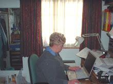
I was born in Toronto and grew up there, attending schools and the local University of Toronto. But in my mid-twenties I left for England, married, settled down, raised a family, and eventually retired. I discovered family history around 1980 and have traced most of my own lines back to at least 1800. One line was living in the vicinity of Toronto even at that early date and another arrived around 1840. These two lines moved into Toronto itself in the 1890s and merged (married) in 1901. The other side of the family arrived from Scotland in late 1903.
My parents lived in Toronto all their lives and had a broad knowledge of the city—living, as one or the other of them did at different times, on the Island, in the “pan-handle” north of Lawrence but still in the city, near Broadview and Danforth, out near the Beaches, on Borden Street, ending up in a condo on the banks of the Humber, their one home outside Toronto proper. Even in her last years after she stopped driving at age 88, Mom could navigate anyone around any part of the city.
I joined a local family history society here in the UK in the early 80s and around the same time we bought our first computer. The two came together when the society decided to transcribe the local census. When the LDS decided to transcrbe the British census of 1881, I did quite a bit of work in my local county of Buckinghamshire and also in Scotland. My three times great grandfather had been census registrar in Rothesay on Bute in 1881. I had the privilege of transcribing out what he had put in.
Once on the internet with what we call a broadband connection and what North Americans call high-speed internet, I started investigating the online resources for Ontario, particularly the area around Toronto. I discovered Ontario GenWeb’s census project and its transcriptions of the 1851 and 1861 censuses of Markham, Vaughan and King townships. It wasn’t just viewing my great-great grandfather’s family in Markham Township that made it interesting, it was looking at all the families. I started to match those which I could find in both 1851 and 1861 censuses. I also found lists of marriages and tied those in too.
I knew we had a local Latter Day Saints Church with a Family History Centre where I could borrow microfilms and inspect them. It appeared that no one had ever attempted to transcribe the York Township census for 1851. Why not try it? So I did. In this case my original transcription was made on pre-designed forms and handwritten in pencil, leaning on a clipboard. The population in that year was just over 10,000.
The process turned out to be not the least bit boring. It was really great fun, especially when I was able to figure out where I was in relation to streets of today. There weren’t any clues to this other than there were two divisions—east and west of Yonge Street. All I could depend on was surnames that linked with later street names, a comment about the building of the original Woodbine racetrack, and railway construction sites. The eastern division stretched from Yonge to Victoria Park and mostly from Steeles Ave down to Bloor St, but east of the Don River, this extended to the lake front. The western division stretched from Yonge to the Humber River and from Steeles to Bloor St West. The accompanying agricultural census listed locations by landowners, and many were not residents.
The following year I transcribed the 1861 York Township census. The population had expanded to 11,500. Locating people was easier this time. There were now seven divisions—three pretty rural ones on each side of Yonge Street and Yorkville, a much more urban village on the edge of Toronto immediately north of Bloor Street. The 1861 agricultural census was more useful, and I did thank the enumerator of Divison Three who made it his business to trace the home address of every servant working in households in his patch.
Where are these transcriptions? Tucked away in my computer, waiting on someone to come along and offer to proofread. Now that the 1851 census is online, it has been transcribed again and is to be found on two different websites, but we must now wait for Ancestry to work through its recent acquisitions from Library and Archives Canada before the 1861 comes online.
Sunday, 4 January 2009
Transcribing the 1861 Census of Toronto
This is not a New Year’s Resolution, but a New Year Decision: it’s time to build a blog!
Since 2005 I have been transcribing the 1861 census of Toronto. So far I have completed the three wards on the east side of Yonge Street (about 25,000 people) and I am currently working on the ward with the largest population west of Yonge Street—St John’s Ward.
When I started I worked with a hand-held computer (or personal digital assistant) which held a copy of Excel. I borrow the microfilms through the Church of the Latter Day Saints and view them at my local Family History Centre. After a day’s transcribing I would come home and upload my files to my desktop computer and add a few additional columns of data which are useful at later stages of the analysis. It was a slow job—on a good day I would complete 25 folios or households. Nevertheless, two wards were completed that way.
In summer 2007 I decided to see whether my digital camera could take pictures off the microfilm reader screen. Once I got a tripod the results were good enough that I switched over to taking pictures at the FHC and transcribing the details from my photos to my spreadsheet at home. I continued to write down the data for each head of household on my PDA while at the Centre. This was in case anything went wrong with the pictures and I had to repeat some shots. But my entry speed moved from 25 households to an average of 60, and I finished off the third ward at a speed that felt like a cloud of dust!
The three eastern wards were complete by October 2007. I then moved the data to Access where it was easier to inspect my findings on a household by household basis. I spent the following year building up my database and comparing the families with the people listed in Caverhill’s Directory of Toronto of 1860 and Mitchell’s Directory of Toronto of 1864. This part of my research is still incomplete but I have reached the letter S. I feel a lot more ahead than when I had only completed up to L.
Since I am not one to take pictures day in and day out, my camera took “a holiday” over several months, and when I brought it out again it had ceased to work. I sent it away for investigation and possible repair. Once I heard the cost of repair I decided that buying another camera was a better option. The second camera is physically smaller than the original but holds a greater number of pixels. This means that I can comfortably lean my hands on the top of the microfilm reader box instead of using a tripod. I use about three shots for each form or schedule. I now consider the pictures I am taking part of my archive, whereas when I first started, they were just a means to an end. Production speed has now moved up to 70 houses per day, but because the FHC is not open as much as it was I am only working two days a week.
Subscribe to:
Posts (Atom)